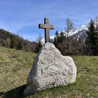
The Auberge la Boerne is a very nice refuge with restaurant located in the hamlet of Tre-le-Champ at the north-western end of the Chamonix Valley. The hamlet of Tre-le-Champs is very beautiful with a great elevated location and wide spread farm houses and chalets around wide pastures. The Auberge sits in a nice location on the crossroads of many trails in the direction of Le Tour and the Aiguillete de Possettes on the northern side. On the western side lies the hamlet of Le Planet and the Montagne de Peclerey. East from the Auberge lies the Lac Blanc and the trail leading through the Aiguilles Rouge nature reserve. Then to the north you will find the Cascade de Berard and the trails leading to the highest summit outside of the Mont Blanc massif, Mont Buet (3096m). So a perfect location for exploring in all directions!
The Auberge has a restaurant serving local Savoyard dishes including Croute and Tartiflette. It has 6 dormitories with a total capacity for 31 guests. The dormitories range in size from 2 to 9 beds and they can take private bookings. The website of the Auberge la Boerne takes online reservations and they generally seem to be open from June to the end of September.
The name "Boerne" comes from the French world for the chimney that was used for smoking meats. The Auberge la Boerne dates back to the 18th century when it was a farm belongning to the Charlet family. Armand Charlet, who was a mountain guide starting accepting guests at the farm. Gilbert, the grandson of Armand took over the farm and turned it into the inn it is today.
The Auberge has its own parking for those coming with their own vehicle. The nearest bus stop is Tre-le-Champ a little north from the actual hamlet. The nearest train station is Montroc-le-Planet which is roughly a 20 minute walk away.
Linked Trails & Points of Interest
These are the trails and points of interests linked to this refuge
7
Our Rating
Good
Trail:
Il s'agit d'une boucle de découverte très agréable et adaptée aux familles, explorant les villages d'Argentière, Le Planet, Montroc et Tré-le-Champ, ainsi que les nombreux points d'intérêt tout au long du parcours.
Length
7.57km
When to Go
Mid May - End Oct
Hiking Time
2.0 - 3.0 Hours
Elevation +
+325m / -325m
Kids
7+ Years old
Running Time
1.0 - 1.5 Hours
Technical Difficulty
Very Easy (1/5)
Dogs
Dogs Allowed
Nearest Town
Chamonix
8
Our Rating
Very Good
Trail:
Une boucle fantastique et adaptée aux familles entre les hameaux du Tour et de Montroc, offrant une belle variété de forêts, de vues et de charmants hameaux.
Length
4.56km
When to Go
End Apr - End Oct
Hiking Time
1.5 - 2.0 Hours
Elevation +
+226m / -226m
Kids
4+ Years old
Running Time
45 - 75 Mins
Technical Difficulty
Easy (2/5)
Dogs
Dogs Allowed
Nearest Town
Chamonix
Location & Map
Below you will the location of this point of interest on the map. You can click the button to show the nearby trails and points of interests that are listed above on the same map. Another option is to visit our complete interactive map that shows everything that is listed on our website.
Longitude:
6.9278
Latitude:
45.995


