top of page

Glacier de Tre les Eaux

Glacier

Contributors:

XXX

6

Our Rating

Above Average

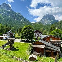
Le Glacier de Tré-Les-Eaux est un petit glacier situé sur le flanc est du Mont Buet, s'étendant depuis la partie inférieure des falaises jusqu'au fond de la vallée en dessous. De nombreuses cartes montrent encore ce glacier avec une taille considérable, mais ces cartes sont obsolètes et le glacier diminue rapidement ; en été, il ne reste pas grand-chose. Il est probable que le glacier disparaisse dans les prochaines années, bien que nous ne soyons pas des experts en la matière.


Il existe un seul sentier qui traverse la vallée de Tré-les-Eaux en venant de Le Lay et de la Vallée de Vallorcine. Il parcourt toute la longueur de la vallée et monte jusqu'au Col des Corbeaux. Nous avons une description détaillée d'un sentier pour l'ascension nord du sommet du Mont Buet qui passe par Tré-les-Eaux. Le sentier passe à proximité du terminus du glacier, mais il n'y a pas de chemin permettant un accès direct à celui-ci.

Nearest town to this point of interest

Nearest Town

Vallorcine

Altitude of this point of interest

Altitude

2380m

Capacity for this point of interest
Accommodation Type
Phone number for this point of interest
Website for this point of interest

Capacity

Accommodation

Phone

Website

Looking for more glaciers?

Linked Trails & Points of Interest

These are the trails and points of interests linked to this glacier.

Le Mont Buet via Tre les Eaux Loop

10

Our Rating

The Best

Trail:

View on Map

Un itinéraire long et exigeant vous menant à travers la magnifique vallée de Tré-les-Eaux jusqu'au Cheval Blanc et au sommet du Mont Buet, avant de revenir en boucle via le Refuge Bérard.

Trail Length

Length

22.3km

When is the best time to go on this trail

When to Go

Mid Jul - End Sep

How long does it take to hike this trail

Hiking Time

8.0 - 13.0 Hours

Elevation gain and loss for this trail

Elevation +

+2103m / -2103m

How old do kids have to be to go on this trail

Kids

15+ Years old

How long does it take to run this trail

Running Time

5.0 - 8.0 Hours

The technical difficulty level of this trail

Technical Difficulty

Very Difficult (5/5)

Are dogs allowed on this trail

Dogs

No Dogs

Nearest Town to this Trail

Nearest Town

Chamonix

Mont Buet Summit

10

Our Rating

The Best

Summit

The highest summit outside of the Mont Blanc Massif at 3096m with great views all around

Nearest town to this point of interest

Nearest Town

Vallorcine

The altitude of this point of interest

Altitude

3096m

View on Map
Col de la Terrasse

7

Our Rating

Good

Le col de montagne rocheux près du Lac Vert entre Loriaz et le Cheval Blanc

Nearest town to this point of interest

Nearest Town

Vallorcine

The altitude of this point of interest

Altitude

2645m

View on Map
Le sommet du Cheval Blanc

9

Our Rating

Exceptional

Un vaste sommet plat s'élevant au-dessus du Lac Vieux Emosson et de Tré-les-Eaux

Nearest town to this point of interest

Nearest Town

Vallorcine

The altitude of this point of interest

Altitude

2830m

View on Map
Col des Corbeux

8

Our Rating

Very Good

Le col de montagne rocheux entre le Cheval Blanc et le Col de la Terrasse

Nearest town to this point of interest

Nearest Town

Vallorcine

The altitude of this point of interest

Altitude

2612m

View on Map
Lac Vert Corbeaux

6

Our Rating

Above Average

Le petit lac près du Col des Corbeaux et du Col de la Terrasse au-dessus de Vallorcine

Nearest town to this point of interest

Nearest Town

Vallorcine

The altitude of this point of interest

Altitude

2606m

View on Map
Le Buet

7

Our Rating

Good

Petit hameau situé à l'extrémité de la vallée de Bérard près de Vallorcine

Nearest town to this point of interest

Nearest Town

Vallorcine

The altitude of this point of interest

Altitude

1344m

View on Map

Location & Map

Below you will the location of this point of interest on the map. You can click the button to show the nearby trails and points of interests that are listed above on the same map. Another option is to visit our complete interactive map that shows everything that is listed on our website.

Longitude:

6.8615

Latitude:

46.0303

Show nearby Trails & Points of Interest

Vous avez quelque chose à ajouter ?

Nous avons commencé au printemps 2023 et nous travaillons dur pour rendre ce site aussi complet et précis que possible. Nous avons besoin de votre aide ! Si vous avez quelque chose que vous aimeriez ajouter, n'hésitez pas à nous contacter.

Chamonix360 n'est pas une entreprise ni une organisation commerciale. Le site est géré par un groupe passionné de trail à Chamonix-Mont-Blanc

© 2023 Chamonix360  

bottom of page